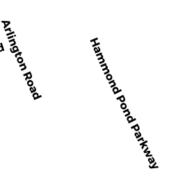
310 HAMMOND POND PKY 203 & G30 & G22
Owner Information
SILBERT TR LARRY
310 HAMMOND POND PKY #203
CHESTNUT HILL, MA 02467


Property Details
310 HAMMOND POND PKY 203 & G30 & G22 is classified as a Residential Condominium (Low-rise).
The primary structure on this property was built in 2008. There is 1,989ft2 of residential/living space within this property. This property is listed as having 5 rooms.
310 HAMMOND POND PKY 203 & G30 & G22 is valued at $1,064,400. The land is valued at $0 and the structures are valued at $1,064,400.
This property is in Zone M10. Confirm with local Zoning Board authorities to ensure there are no overlays or other easements on this property.
The most recent deed for 310 HAMMOND POND PKY 203 & G30 & G22 is recorded at the local registrar in Book 36762, Page 560. 310 HAMMOND POND PKY 203 & G30 & G22 was last sold on Tuesday, April 30, 2019 for $1.
Assessment data from fiscal year 2021.
Flood Data
According to the FEMA National Flood Hazard Layer, this property does not appear to be in a flood zone. It may also be in an area not yet reviewed. Nonetheless, confirm this information prior to taking any action.
To view the flood hazards around this property, create a FEMA "Firmette" Map of the area around 310 HAMMOND POND PKY 203 & G30 & G22.
Broadband Internet Providers
| Provider | Type | Bandwidth (mbps) | |
|---|---|---|---|
| Comcast | Cable | 1000 | 35 |
| Verizon New England Inc. | Fiber | 940 | 880 |
| HughesNet | Satellite | 25 | 3 |
| VSAT Systems, LLC. | Satellite | 2 | 1 |
| Verizon New England Inc. | DSL | 5 | 0 |
| Viasat Inc | Satellite | 100 | 3 |
| GCI Communication Corp. | Satellite | 0 | 0 |
| T-Mobile | Fixed Wireless | 25 | 3 |
| RCN | Cable | 1000 | 20 |
| RCN | Cable | 500 | 20 |
| Crown Castle Fiber | Fiber | 0 | 0 |
Broadband service provider data from December 2020.
Adjacent Properties
- 779 781 HEATH ST
Two-Family Residential owned by CHEN TRASONG - 9 11 BELMONT RD
Two-Family Residential owned by COYLE EDWARD C - 15 17 BELMONT RD 1
Residential Condominium owned by KADIS LIFE ESTATE DORIS - 15 17 BELMONT RD 2
Residential Condominium owned by PICARD TR JOYCE K - 320 HAMMOND POND PKY
Apartments with More than Eight Units owned by LEVENSON, TR NORMAN A - 763 HAMMOND POND PKY
Dept. of Conservation and Recreation (DCR) - Division of Urban Parks and Recreation (non-reimbursable) owned by COMMONWEALTH OF MASSACHUSETTS